
The digital ether hums with unseen data, a constant flow of information painting a picture of our world. Google Earth, a seemingly benign tool for armchair exploration, has become an unwitting repository of anomalies, a digital canvas where the mundane meets the mysterious. We’re not just looking at satellite imagery; we're peeling back layers, exposing secrets etched onto the planet's surface that defy simple explanation. Today, we're venturing into the uncharted territories of Google Earth, not to map vacation spots, but to dissect the digital breadcrumbs left behind by history, conflict, and the sheer, unadulterated strangeness of our existence.
This isn't about casual browsing; it's about critical analysis. Every odd shape, every suspicious structure, every persistent anomaly visible from orbit is a potential data point, a whisper from the past that demands investigation. We'll delve into the implications, explore the theoretical underpinnings, and, where possible, offer a technical perspective on why these 'hidden' elements persist in our globally mapped world. The goal is to transform passive observation into active intelligence gathering. Forget the tourist traps; we're hunting for the ghost in the machine, the digital sentinel guarding forgotten truths.
Table of Contents
- Europe: Echoes of the Iron Curtain
- Asia: A Tapestry of Enigmas
- Antarctica: Frozen Secrets in the Ice
- Africa: Monumental Mysteries of the Past
- The Americas: Eyes That Never Sleep
- Veredicto del Ingeniero: The Digital Reconnaissance Imperative
- Arsenal del Operador/Analista
- Preguntas Frecuentes
- El Contrato: Your Reconnaissance Mission
Europe: Echoes of the Iron Curtain
The scars of geopolitical conflict are not confined to history books; they are etched onto the very land. In Europe, Google Earth reveals the stark realities of the Cold War – abandoned military bases, missile silos long decommissioned but eerily preserved, and the spectral outlines of border fortifications. These aren't just relics; they are dormant systems, potential points of interest for threat actors seeking forgotten infrastructure or historical data troves. Understanding their persistence in public mapping services highlights how easily residual strategic assets can become overlooked in modern surveillance. The sheer scale of these installations, visible only from a detached, digital perspective, underscores a period of intense, covert technological development.
Asia: A Tapestry of Enigmas
Asia, a continent brimming with ancient history and rapid modernization, presents a unique set of visual puzzles. From sprawling, unidentifiable urban developments that appear overnight to remote scientific facilities and enigmatic geological formations, the satellite view offers a glimpse into secrets often shielded by distance or governmental discretion. We've encountered vast, geometric crop circles that defy natural explanation and evidence of large-scale, uncatalogued construction projects. Analyzing these requires cross-referencing with open-source intelligence (OSINT), looking for patterns, and questioning the official narrative. The challenge lies in distinguishing between natural phenomena, clandestine operations, and outright misinformation.
Antarctica: Frozen Secrets in the Ice
The vast, frozen expanse of Antarctica is less a blank slate and more a meticulously preserved archive. Beneath the ice, theories abound regarding ancient structures, clandestine research stations, and geological oddities that challenge our understanding of planetary history. Google Earth, while limited by its ability to penetrate deep ice, can still reveal surface anomalies – unusual ice formations, seemingly artificial patterns, and the ghostly outlines of abandoned expeditions. These are not mere curiosities; they are potential indicators of undiscovered scientific data or locations of historical significance that demand rigorous, empirical investigation. Consider the implications for data integrity and the potential for hidden research that predates modern scientific endeavors.
Africa: Home of the Mysterious Pyramids
Africa's rich historical landscape is a fertile ground for discovery, with Google Earth providing a new lens through which to view ancient wonders and modern enigmas. The pyramids, of course, stand as enduring testaments to lost civilizations, but the satellite view reveals more: hidden settlements, ancient roadways lost to time, and vast, undeveloped territories that could still harbor undiscovered archaeological sites. The persistent allure of the pyramids, visible from space, serves as a microcosm of Africa's latent secrets, urging us to look beyond the obvious and analyze the deeper patterns of human and geological history.
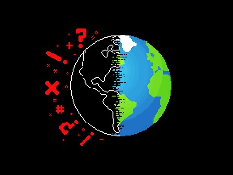
The Americas: Forever Watching
In the Americas, Google Earth paints a picture of both sprawling human endeavor and pervasive surveillance. We see vast networks of infrastructure, sprawling industrial complexes, and remote military installations. But beyond the obvious, there are the subtle indicators of ongoing monitoring – the placement of satellite dishes, the patterns of security patrols visible from orbit, and the sheer density of data collection points. This continent serves as a stark reminder that in the digital age, borders are permeable, and the 'eyes' of observation are everywhere, constantly collecting and analyzing. This raises critical questions about data privacy and the infrastructure of global information warfare.
Veredicto del Ingeniero: The Digital Reconnaissance Imperative
Google Earth is more than a mapping service; it's a readily accessible reconnaissance tool. Its value lies not just in identifying known entities, but in spotting the anomalies, the deviations from the expected. For security professionals, bug bounty hunters, and threat intelligence analysts, it's an indispensable asset for initial site surveys, understanding physical infrastructure proximity to digital assets, and uncovering potential points of interest that might otherwise remain hidden. The ability to discern meaningful patterns from vast datasets is paramount. While this post highlights intriguing discoveries, the true value lies in applying these observational techniques to proactive security measures. Dismissing these discoveries as mere curiosities is a critical oversight; they are data waiting to be weaponized—for defense. The question isn't 'what' these things are, but 'how' they impact security postures.
Arsenal del Operador/Analista
- Software de Análisis Geoespacial: Google Earth Pro, QGIS, ArcGIS (para análisis más profundos y superposición de datos).
- Herramientas OSINT: Maltego (para visualización de relaciones), Shodan (para activos de red expuestos), Recon-ng (framework de reconocimiento).
- Navegación y Visualización: A través de la propia interfaz de Google Earth, explorando capas históricas y terrenos.
- Documentación y Archivo: Evernote, OneNote, o incluso un simple archivo Markdown para registrar hallazgos y correlaciones.
- Análisis de Vídeo: Herramientas como FFmpeg para extraer fotogramas clave o analizar secuencias si se encuentran fuentes de vídeo relevantes.
- Libros Clave: "The Mapmaker's Eye: David Rumsey and the Power of the Map", "GIS for Everyone" para entender las bases del análisis geoespacial.
Preguntas Frecuentes
- ¿Es Google Earth seguro para el análisis de seguridad?
Sí, Google Earth Pro ofrece funcionalidades avanzadas para la recopilación de inteligencia geoespacial, pero siempre opera dentro de los términos de servicio y considera las implicaciones de privacidad de la información que recopilas. - ¿Google Earth muestra información en tiempo real?
No, Google Earth utiliza imágenes satelitales y aéreas que se actualizan periódicamente. No es una fuente de datos en tiempo real para eventos inmediatos. - ¿Cómo puedo identificar anomalías "sospechosas" en Google Earth?
Busca patrones inusuales, estructuras que no parecen naturales, desarrollos masivos sin explicación aparente, o el uso de infraestructura estratégica en ubicaciones remotas. La clave es la comparación y el cuestionamiento constante. - ¿Qué debo hacer si encuentro algo potencialmente sensible o ilegal?
Dependiendo de la naturaleza de lo que encuentres, considera reportarlo a las autoridades pertinentes o a plataformas de divulgación de seguridad, siempre actuando dentro del marco legal y ético.
El Contrato: Your Reconnaissance Mission
The digital veil is thin, and the secrets it hides are numerous. Your contract is simple: become the digital cartographer, the unseen analyst. Select a region you find intriguing, be it historically significant, geographically remote, or simply the subject of local rumor. Utilize Google Earth's tools – zoom, historical imagery, perhaps even overlaying external data if you're technically inclined – to conduct a thorough reconnaissance. Document at least three distinct anomalies or points of interest that pique your curiosity. For each, formulate a hypothesis: What is it, why is it there, and what are its potential implications in a security context? Your mission is to observe, analyze, and theorize. Prove that you can see beyond the surface. Show us what you find, and more importantly, how you interpret it.
``` ```html
No comments:
Post a Comment